News
Bureau Veritas launches Reshape Your Laboratory, a suite of solutions services dedicated to testing laboratories
PLOT MANAGEMENT BY SATELLITE
PLOT MANAGEMENT
BY SATELLITE
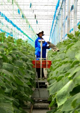
Monitoring the evolution of your crops is a priority to ensure the yield and quality of your products.
Plots of land that are often large or far apart over a vast territory require investments in time and travel.
myPRECIfield® is a digital platform that allows you to monitor your plots of land in 24 hours from a computer, tablet or mobile phone.
REQUEST A DEMONSTRATION AND ASK OUR EXPERTS YOUR QUESTIONS
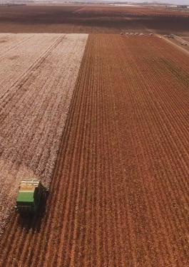
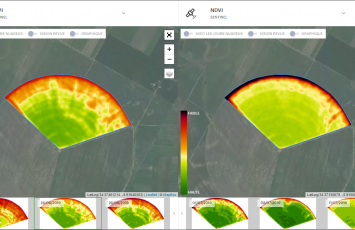
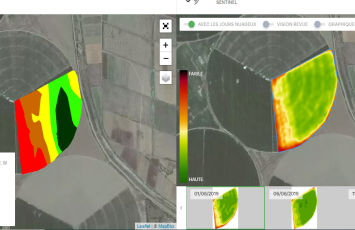
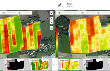
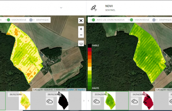
Every 5 days, satellites capture images of your plots providing key data & deeper insight allowing you to compare maps with each other, resulting in the best agronomic decisions being made. Our innovative solution allows interested parties to monitor crop evolution and identify potential growth or yield problems which helps to maximise farm efficiency.
myPRECIfield® in video (french only)
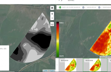
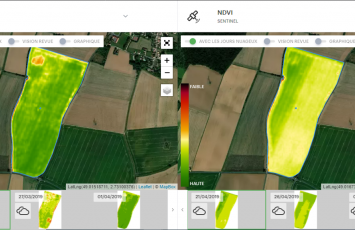
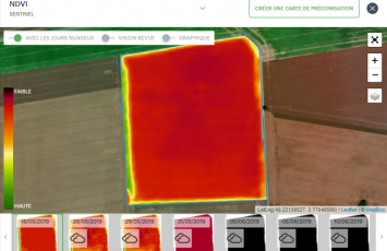
INDEX MEASUREMENT
- NDVI (Normalized Difference Vegetation Index): an index adapted to the monitoring of all crops because it reflects the chlorophyll activity of the plants and makes it possible to follow the evolution of the biomass and plant health.
- NDRE (Normalized Difference Red Edge Index): a measure of the chlorophyll activity of plants that allows monitoring later in the life cycle of crops thanks to a saturation level lower than NDVI.
- LAI (Leaf Area Index): the index refers to leaf area. It can be calibrated to field models and is available in high resolution.
We offer a complete list of indices according to your needs.
BENEFITS
- Visualize all your plots quickly without having to move around in each of them; The data are obtained from the European Space Agency's SENTINEL 2 constellation satellites. These satellites fly over the Earth every 5 days, which allows a high image frequency.
- Improving your resources: monitoring of irrigation systems, fertilizers, phytosanitary products, etc.
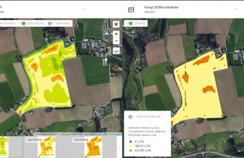
- Optimize input usage: create modulation maps to bring the right dose to the right place
- Reduce your costs by interpreting satellite images prior to field work
- Position your soil, dry matter, etc. analyses in the most appropriate places. Our Labomag laboratory accompanies you throughout your analyses. READ MORE
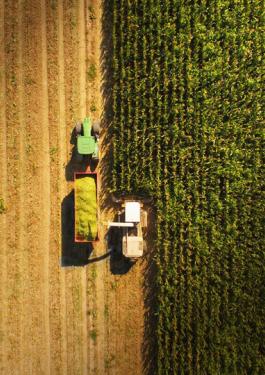
CROP EXAMPLES
WHY CHOOSE MYPRECIFIELD®
- Set up in 24 hours
- Bureau Veritas’ experts will support you throughout your production cycle, monitoring your crops and harvests, as well as your inspection, analysis and certification needs.
- An easy-to-use platform
- Demonstration and online training by our experts